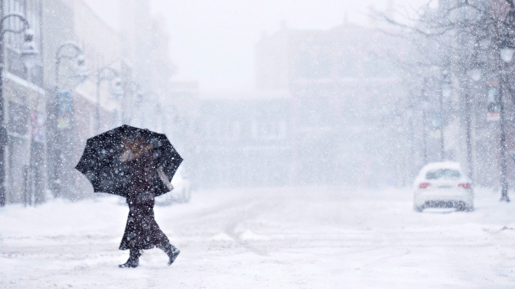
Winter Weather Advisory Issued for Ontario
As winter continues to assert itself, a significant winter weather system is making its way across Ontario, affecting regions from Toronto and the Greater Toronto Area (GTA) to Sault Ste. Marie and Ottawa. Environment Canada has issued a winter weather advisory for much of the province, with snow expected to begin falling on Monday, just days before Christmas. This advisory covers a vast area, impacting local travel, daily commutes, and holiday plans.
In particular, snowfall accumulations are expected to be substantial, with the Greater Toronto Area bracing for between 5 to 15 cm of snow. Snow will move into the region early Monday, with lighter snowfall in the morning before more significant accumulations hit in the afternoon and evening. The forecast calls for a brief break in between snowfalls, but travel conditions could become challenging as the storm progresses.
Detailed Snowfall Predictions Across Ontario
According to Environment Canada’s meteorologists, the snowfall will vary significantly by location. While Toronto is expected to receive around 5 to 10 cm of snow in its downtown core, areas in the northern GTA may see up to 15 cm. Further east, including Georgian Bay and parts of eastern Ontario, snowfalls could reach 15 to 20 cm, causing potential disruptions in travel. The heaviest snowfall is expected to occur late Monday afternoon into the evening, with hazardous road conditions a significant concern.
Regions like Parry Sound and Bracebridge, as well as areas just north of Kingston such as Smith Falls and Perth, are under snowfall warnings. These areas could receive up to 20 cm of snow, with rapidly accumulating snow creating poor visibility and difficult driving conditions.
Snowstorm Type: Alberta Clipper
The storm system making its way through Ontario is known as an Alberta Clipper. These systems are typically fast-moving and relatively drier than larger, slower-moving winter storms. Originating in the eastern slopes of the Rocky Mountains, Alberta Clippers bring lighter but faster snowfalls that can accumulate quickly. While they tend not to bring significant moisture, their speed means that they can impact travel more abruptly than other storm types.
Global News meteorologist Ross Hull explained that the Great Lakes often enhance snowfall amounts as the Alberta Clipper moves through, which could mean increased snowfall for regions downwind of the lakes. Areas around Toronto and the GTA could experience sharp transitions in snowfall, leading to slick roadways and poor driving conditions.
A White Christmas for Ontario?
With this substantial snowfall expected in the lead-up to Christmas, Ontario residents can expect a white Christmas, especially in Toronto and the southern parts of the province. Environment Canada defines a “white Christmas” as having at least 2 cm of snow on the ground by 7 a.m. Christmas morning. Given the current forecast, this will almost certainly be the case for Toronto, with additional snow adding to the pre-existing snow cover from earlier in December.
Temperatures are expected to hover just above freezing on Christmas Eve, with a low of around -9°C with wind chill on Monday night. As temperatures drop further through Christmas morning, the snow is likely to remain in place, preserving the festive white landscape.
Travel Impact and Safety Tips
With snow expected to fall heavily in the late afternoon and evening on Monday, those planning to travel for last-minute Christmas shopping or family visits should take extra precautions. Traffic could be significantly impacted, with reduced visibility and slick conditions making driving hazardous.
Here are a few tips for safe travel during winter storms:
- Plan Ahead: If possible, complete essential travel early in the day before the snow intensifies.
- Drive with Caution: Slow down and maintain a safe following distance, as roads will be slick.
- Prepare Your Vehicle: Ensure your car is equipped with winter tires, windshield washer fluid, and a full tank of gas.
- Stay Updated: Keep an eye on weather updates from Environment Canada for any changes in the advisory or warnings in your area.
For commuters in the GTA, public transit may also face delays. With snow and freezing conditions expected, be prepared for possible disruptions on buses, subways, and commuter trains.
A Look Ahead: Temperature Changes and Weekend Outlook
As the storm clears, the temperature is expected to rise above freezing later in the week. This will likely cause some melting, especially in Toronto and other urban areas where the snowpack may struggle to persist as temperatures hover around 0°C. However, rain is also in the forecast, which may further contribute to the melting and potentially cause icy conditions on the roads.
Snowfall Across Ontario: A Comparison with Regional Averages
For context, the Greater Toronto Area has already received over 15 cm of snow this December, falling well below the monthly average of 24.9 cm. However, northern Ontario, particularly areas around Georgian Bay, have received far heavier snowfalls, with some areas seeing over 1 meter of snow so far this season. While southern Ontario’s snowfall may be less substantial compared to these northern regions, the impact of this upcoming storm should not be underestimated.
Conclusion:
This winter weather system is a reminder that Ontario is in the heart of its snow season, and residents should be prepared for the challenges that come with it. Whether you’re heading out to do last-minute holiday shopping or traveling across the province, understanding the forecast and taking necessary precautions will help ensure your safety.
With the potential for significant snowfalls and hazardous driving conditions, stay informed about the weather advisories in your area, plan your travel accordingly, and embrace the holiday season with the knowledge that this year’s white Christmas is all but guaranteed.
